When it comes to trekking in Munnar region, the popular option is the trekking to Meesappulimala – the second highest peak in the Sahyadris. But there are also various other beautiful and lesser known paths nearby. Lakshmi Hills is one such choice for trekking. It may not be as high as Meesappulimala in terms of elevation, but the landscape through which the route passes are beautiful, sometimes more than the other hills. Read more about the trekking and watch photos from my trekking to the place.
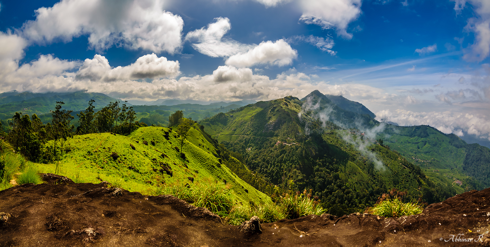
This is a panorama I took on the way to the top. This picture itself will be enough to convey the natural beauty of Lakshmi Hills. Isn’t it breathtaking?
About the trekking to Lakshmi Hills – Munnar
Lakshmi Hills range is on the northern side of NH 85 just before reaching Munnar from Kochi side. The trek starts from near old Munnar. The route is around 14 kilometers including ascend and descend. The total distance can rise to 23 kilometers if you chose to go to to the topmost point at an elevation of about 1870m. The lower point is about 1790m high. The starting point (from NH 85) is about 1450m high. So the total altitude gain is 340 – 420m depending on the destination. But the cumulative elevation gain is higher as there are multiple uphill and downhill climbs. This trek should be done in one day.
The descend is fairly easy. One can see Pallivasal and Anachal areas towards the south. The trek ends at a paved road which joins the highway near KSRTC stand.
Difficulty: According to me, trek is not easy, but is somewhere between moderate to easy, depending on your fitness levels.
Vegetation: The route first passes through tea estates. Then comes grasslands rich with where we could see many types of flowering and non-flowering plants – a good ecosystem for butterflies and other insects. Then comes shola forests where we could spot a Black and Orange Flycatcher. And on the top, we could spot and photograph the Nilgiri Pipit – another western ghats endemic bird on the same day other than the Black and Orange Flycatcher.
The trek route passes through private tea estates and revenue lands. So you will need someone who can take you on this route. We seek the help of Mr. Vinod Thattekad to guide us during this trek.
Unlike other destinations in Munnar, this place is not crowded with tourists and is not a popular route too.
See also: Trekking to Thoovanam Waterfalls.
Photos from Lakshmi Hills
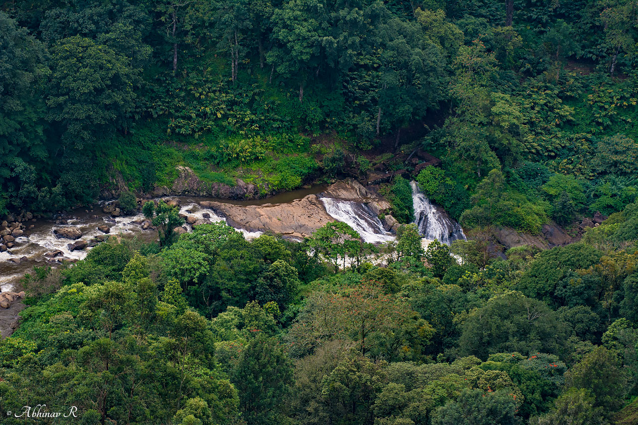
River and waterfall viewed in the downhill.
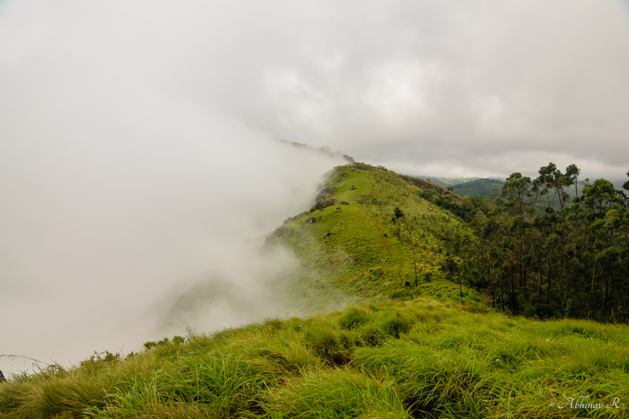
The way to the top. Also see the fog descending.
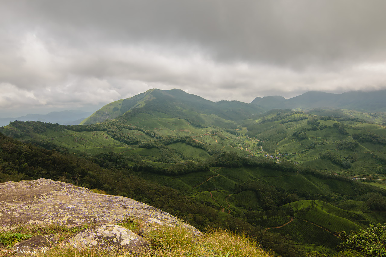
View from the top. The higher peak is seen on the other side.
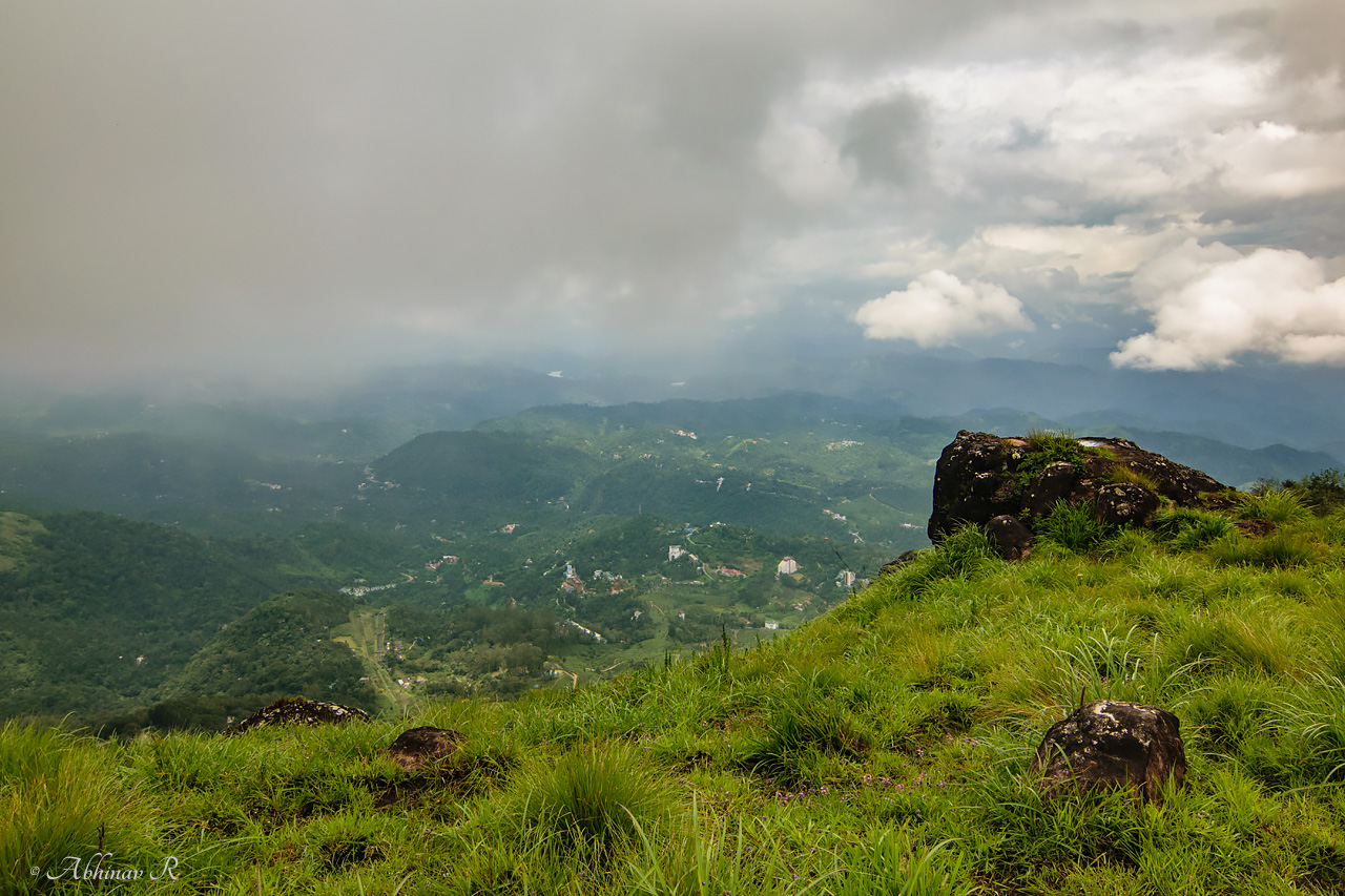
Anachal and Pallivasal regions viewed from top.

The western ghats endemic Nilgiri Pipit clicked from the top.
Best season to visit Lakshmi Hills
We did the trek in August, when the monsoons had not ended. On that day the climate was constantly changing – we saw rain, sunshine and fog within the span of a couple of hours. In fact that is one reason we chose Lakshmi Hills instead of others. Other destinations like Chokramudi were not safe to go because the path was slippery. This place has less rocks on the way, so less slippery. But it is better to avoid the months of heavy rain.
October to February is a good time to visit the Lakshmi Hills.